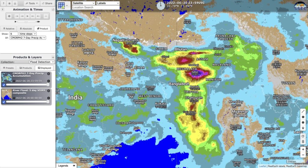
The five-day composite of the VIIRS flood product is just one flood product that can be viewed in RealEarth. VIIRS is an instrument aboard SNPP and NOAA-20, which are low earth orbiting satellites. This means that while only two daytime observations may be retrieved per day over a given region, the spatial resolution of 375-m is quite highly resolved. VIIRS flood composites, such as the five-day composite, provide the “maximal flood extent” during flood events. More information about VIIRS and other satellite flood products can be found here.
In areas of Bangladesh and northwest India, persistent rains have caused recent heavy flooding. Millions of people have already been displaced and the flooding is forecast to continue. The VIIRS five-day flood product composite over a six-day time period can be seen below, with the 7-day CMORPH2 satellite-derived precipitation accumulation product. Comparing the images, the spatial placement of flooding with accumulated precipitation coincides well.